
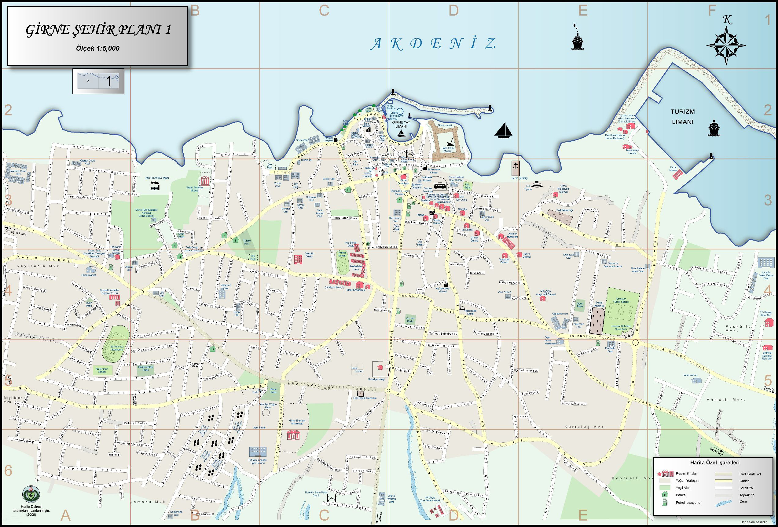
Please click on the picture of the map below for a larger image. Although in Turkish, many visitors will find this map of use. When reading the map, Sokak means street and Cd stands for Caddesi, which means its a main road. Thank you to the KKTC Map Office for permission to share it.
 Below you will also find the Google map of Kyrenia which you can zoom in or out off. If you click on the small box on the bottom left hand side, you will see the satellite view of the city.
Turkish translation
Yukarıda Girne’nin bir harita bulacaksınız. Dışarı kapalı veya yakınlaştırabilirsiniz.
Eğer sol alt taraftaki küçük kutu üzerine tıklarsanız, şehrin uydu görünümünü göreceksiniz.
The earliest reference made to the town of Kyrenia is found, together with that of the other seven city kingdoms of Cyprus, in Egyptian scripts dating from the period of Ramesses III , 1125-11 BC.